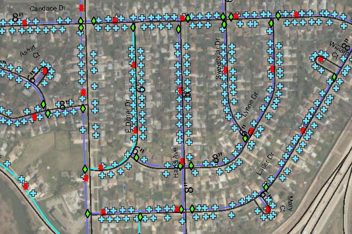
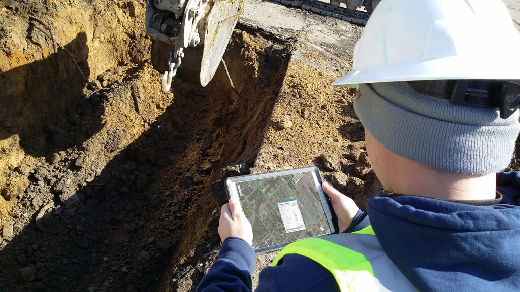
GIS data and rich visualizations play an integral role in helping municipalities manage their infrastructure. And today’s custom GIS technologies and services enable municipalities to make decisions based on real-time data to prioritize and optimize their asset management in the most cost-effective manner.
Funding for Community Resilience
It’s no secret that a large portion of our nation’s infrastructure needs repair—roads, bridges, water systems, the power grid. The Senate recently passed the $1 trillion Infrastructure Investment and Jobs Act (IIJA) to repair aging public works projects and much more.
This legislation is vital for community resilience regardless of economic status. Time and energy are required to not only apply for funding, but to appropriate the funds to the right projects at the right time. Grant applications often require up-to-date asset management plans to demonstrate that applicants plan to put the money to the highest and best use based on community goals and regulatory needs.
Digitized Asset Management
GIS forms the foundation of digitized asset management, so the more information the city has at their disposal the better. Strategic, effective decision-making is so important in today’s municipal landscape. Knowing the full scope of the infrastructure inventory—including existing conditions—helps municipalities maintain and preserve assets to maximize budgets and community impact.
Prioritizing work with field staff is much more efficient when maintenance, repairs, and replacements can be grouped according to location, condition, etc. During large-scale capital improvement plans, where engineering, environmental, planning, operations and maintenance, and leadership teams meet regularly, having an accurate asset inventory helps the team move proactively through planning, design, and construction.
“Our municipal clients use location-based ArcGIS apps on their phones and tablets in the field to update asset status in real time. Having a unified system with accurate data helps them work smarter and faster.”
Digital asset inventories can also help a city, town, or village take more control of their financial future by enabling land use planning and development initiatives. Location intelligence helps developers minimize risk by serving up real-time, integrated, custom data sets that provide a more complete picture of available properties.
Digitized assets are even more important today as many municipal department leaders transition into retirement. Institutionalizing data is a critical step to preserve knowledge gleaned over decades of on-the-job experience.
Creating Custom GIS Datasets
GIS teams often receive off-the-shelf packaged data from an economic development group, county, or regional organization. These standard files contain information and locations of parcels, ownership, potentially endangered species, and wetlands, to name a few.
Custom GIS takes this information further by personalizing the data based on a community’s specific infrastructure, enabling collaboration between team members and departments so everyone from municipal engineers to field teams to city leaders benefit from the data.
Manhole Scanning
Manhole scanning is an effective way to verify and digitize infrastructure. The scanner is a mobile device that is attached to the back of a van. This piece of equipment can be carefully lowered into a manhole structure and capture a 360-degree image of the inside of the entire structure. Once the image is captured it can be evaluated on the laptop in the van or back at the office. Scoring of the structure can be conducted following the NASSCO MACP standards. Having access to an accurate image of the structure helps assess condition and verify flow and connectivity within the system. In Highland Park, for example, the city’s old, paper-based maps didn’t represent current conditions, leaving municipal leaders and engineering teams in the dark. Not only did MCA’s team update and digitize all the data, we used the manhole scanner to visualize and document manhole conditions for stormwater, sanitary, and mixed water sewage systems and how the underground infrastructure elements connect to each other.
RTK GPS Tools
Municipalities and GIS teams benefit from tools like real-time kinematic positioning (RTK), which is a highly accurate, survey-grade Global Positioning System (GPS) that simultaneously collects and corrects location data while offering the positional accuracy of 1cm. MCA uses RTK systems on behalf of municipalities to collect asset locations at the survey grade.
For municipal water main replacement programs, the RTK unit collects extremely important information like top of pipe, bends, tees, elbows, and other water main features. The GIS team, now armed with precise location information, confidently draws in the water main and other infrastructure elements like manhole structures, inlets, water valves, curb stops and fire hydrants. Accuracy is important to future engineering designs, MISSDIG locating, leak detection, or locating in the event of vegetation overgrowth or over paving.
Reducing Risk Exposure
City of Saginaw, MI

Following Pipeline Assessment Certification Program (PACP) standards and manhole inspections per Manhole Assessment and Certification Program (MACP) standards and inspections, MCA developed a comprehensive wastewater asset management plan for the city’s combined sewer system which helped the city define risk exposure and review lifecycle cost evaluations. Read more…
Capital Improvement Planning
City of Rockwood, MI

MCA captured locations for hydrants, valves, meter pits, and curb stops which integrated into the city’s digitized water main line maps to facilitate a complete Water Distribution Asset Management Plan. GIS data helped determine criticality of the system and informed their 5-year and 20-year planning cycles. Read more…
Beyond “Off the Shelf” Data
Custom GIS is one way to systemize your data for lifecycle management or to smooth the way for capital improvement projects.
The key to developing high-value custom GIS data solutions is multi-disciplinary teaming to define and implement project plans:
- Experienced, in-house municipal engineering teams that understand relevant use cases
- Certified GIS staff with experience delivering insights for municipalities, real estate, and civil engineering organizations
- Field staff with specialized knowledge to conduct manhole scanning and RTK data collection
Custom GIS and digitized asset management helped secure grants and loans needed to bring Highland Park’s water system into compliance while streamlining operations as the city’s water department returned to a full operation. Their database also helps develop and track work orders. Field teams and third-party vendors can be deployed to a location with a clear picture of conditions. It has really helped create efficiencies within the department.
Creating digital asset inventories is an upfront investment from a financial and operational standpoint. Given our nation’s aging infrastructure, tight budgets, and ever-changing regulatory environments, there’s not much room for the reactionary time and budget allocations that come from emergency repairs—many of which could likely have been avoided when the right information is at hand. Today, it’s imperative we find ways to work smarter.
At Metro Consulting Associates (MCA), we push the GIS framework beyond ordinary data science. We don’t just gather, manage, and analyze “off the shelf” data. We specialize in data collection methodologies tailored to your proprietary assets and project needs for custom solutions. Our integrated, multi-disciplinary team approach is rooted in geographic science, and combines advanced technologies with the human art of data visualization to help you make smart, informed decisions.
Contact our team to get started.


