
Imagine a future where your municipality’s asset management system is streamlined, modern, and efficient. With improved performance, advanced data modeling, powerful visualization, and future-ready applications, Esri’s ArcGIS Pro and its utility network offer clear benefits that will level up your municipal GIS operations.
Migrating to this advanced system is no small feat. By following key best practices, like determining data necessity, cleaning your datasets, updating naming conventions, and preparing subnetwork data, you can set your municipality up for a successful migration.
Determing the Necessity of Datasets
Although seemingly simple, assessing datasets to determine necessity is tedious and can dramatically extend the data migration when not completed beforehand. Reviewing datasets, layers, and fields to decide whether they need to be migrated or left behind will streamline the process.
If the municipality has necessary data that doesn’t fit within the new network’s standardized system, it should be determined how it will be transitioned into a different part of the GIS.
Clean Dataset
To expedite the migration’s quality assurance processes, the municipality must clean its data. A validation test is run to identify errors within the asset management system. This is most efficiently completed by a GIS consultant because it requires licensed third-party software and years of expertise.
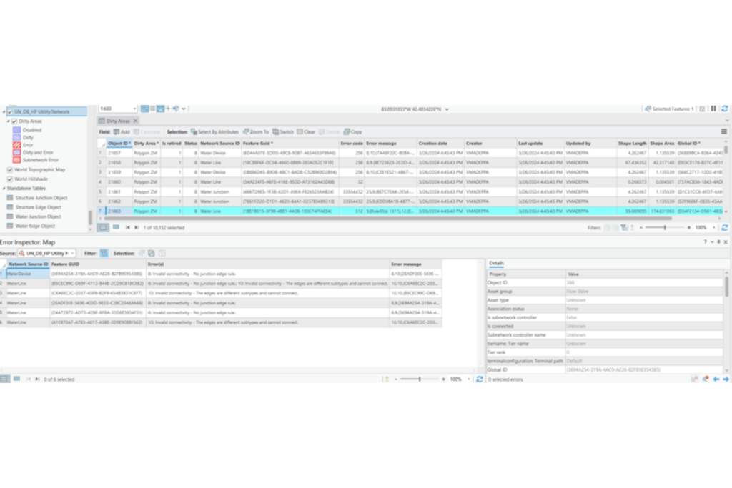
The image above illustrates the Dirty Areas Attribute Table and Errors Inspector in ArcGIS Pro Utility Network Toolkit.
Throughout the test, errors such as duplicate data points or sharp infrastructure edges are identified and resolved through field investigations and data updates. Although solving the data may take a while, depending on the errors and the municipal engineer’s capacity, it will streamline the migration and ensure municipal GIS operations hit the ground running once the new system is in place.
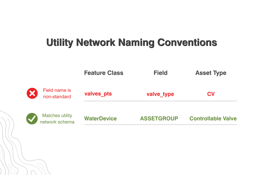
Use Utility Naming Conventions
ArcGIS Pro’s utility network is rule-driven, meaning if data names don’t match the system’s standards, features won’t load correctly, domain mappings fail, rules don’t apply, and you get errors while performing activities.
Because of this, municipalities must update their naming conventions to match the new utility network’s feature classes, subtypes, fields, and domains. Updating these will ensure a smooth transition and effective operations afterward.
Prepare Subnetwork Data
GIS systems are efficiently broken into different areas based on the equipment involved in the service. it’s immensely beneficial for a municipality to define subnetwork data before migration. Setting up subnetworks and subnetwork controllers establishes clean, reliable operational workflows, such as isolation or zone tracing.
Preparing subnetwork data beforehand allows the municipality to validate topology before migration, reducing errors during deployment and maintenance.
Start Your Migration Today
Following these four best practices sets your municipality up for a successful data migration. An experienced and knowledgeable GIS team working with your municipality throughout the migration is key to ensuring a smooth and efficient transition.
Let Metro Consulting Associates (MCA) be your trusted partner, tackling the heavy lifting and setting up your GIS operations team for elevated processes and procedures in the long run.
Unlock new GIS capabilities. Contact our team today for a preliminary consultation.

