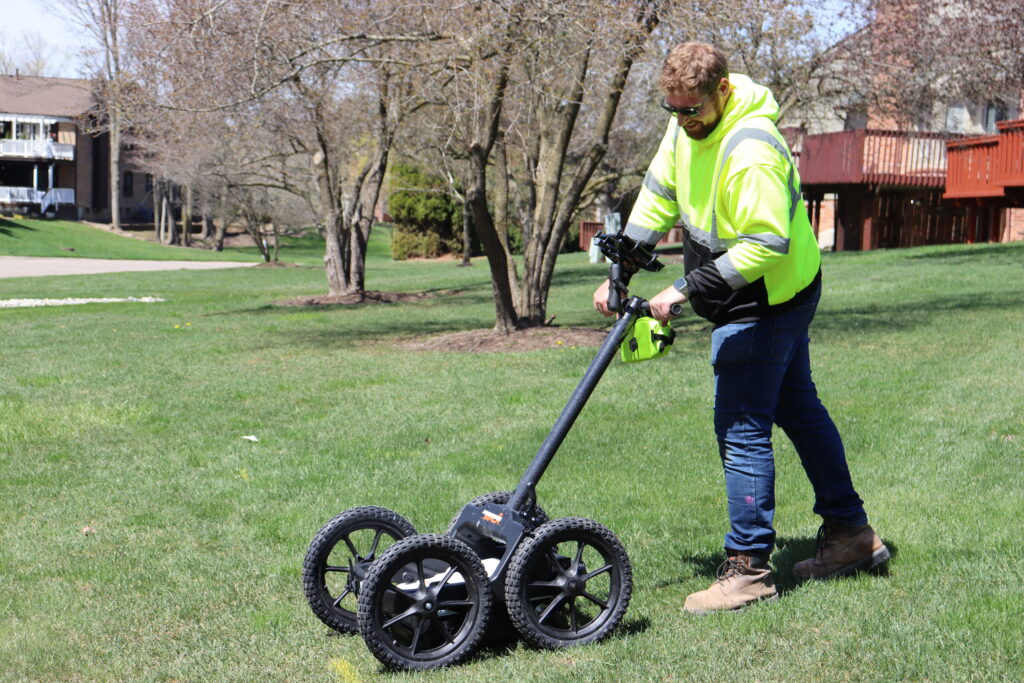
GPR: The Multi-Market Tool
Ground penetrating radar – often referenced as GPR – can do amazing things. From completing snow analyses in Antarctica to archaeological excavations, GPR can suffice as an invaluable tool, spanning dozens of markets.
A little closer to home, MCA utilizes GPR to provide utility locate and mapping services. It’s an integral tool that adds information to projects across numerous markets on multiple levels—quite literally. With quality ground conditions, the GPR utility locate technician is able to gather the location and elevation of an item underground by emitting a signal and interpreting the frequency and velocity that returns.
MCA has developed an expertise and highly qualified portfolio of GPR and utility locate mapping services for clients. Based on our 450 Mhz antenna frequency, the GPR unit is an efficient tool in four main markets: construction, geotechnical, land surveying, and utility design and planning.
GPR as a Construction Tool
For pre-construction and active construction projects, GPR utility locate mapping serves as a damage-prevention tool on two levels. First, it avoids added project costs by preventing excavations from turning into treasure hunts, discovering obstacles, and extending the schedule to days on end. Second, it ensures site crew safety, making the insurance GPR provides invaluable.
Although this service cost is not always initially accounted for, if used properly, it will save labor and labor costs on the project. The GPR utility locate technician can efficiently scan the project site and provide a blueprint for excavation, locating “clear areas” and where to proceed with caution.
Whether it is new construction developments or renovations of aged developments with a lack of proper utility mapping, GPR utility locates mapping provides the contractor with a plan to safely excavate or start directional drilling.

The image above shows a deliverable of an area scanned to identify current utilities in a mobile home park with many private facilities. This allows the contractor to enter this project and utilize Horizontal Directional Drill technology rather than soft excavating the entire project.
GPR as a Geotechnical Tool
Geotechnical firms can take advantage of GPR locate and mapping services to see where they can best drill complete their testing. GPR can serve as a valuable tool for two main services in the geotechnical market: void detection and borehole clearing.
If the contractor is looking to excavate a large area or is experiencing soil erosion, void detection is performed by the utility locate technician to assess where the soil is flowing.
Voids are identified in the GPR scan as a straight vertical line, as shown below.

Once the empty space is found and the location is provided to the client, they can appropriately pump grout into the ground to resolve the issue and continue with their project.
Before geotechnical companies complete soil borings, the GPR utility technician can search for and identify any potential utilities that could be interfering with plans. This process is quick and easy to perform and provides the client with a snapshot of the obstacles they’re working with underground, as shown below.

With the snapshot, the contractor can determine how to proceed with an idea of what to expect when they start drilling, preventing damage and ensuring project efficiency.
GPR as a Land Surveying Tool
GPR utility locate mapping is an exceptional tool for land surveying services, especially for topographic surveys. A GPR utility locate technician can quickly and efficiently gather raw data points to provide land surveyors with a foundation of what to expect when surveying the project site. Additionally, GPR utility locate mapping supplements land surveyors’ drawings with elevation information to provide a comprehensive visualization of the project site.

As seen above, the technician’s data is provided to land surveyors as black points labeled by utility type, with an accompanying spreadsheet of points.
Order the Right Survey for Your Project
A survey means different things to different people, and many don’t know which type of land survey they need. Learn more about the seven most common land surveys.
GPR as a Utility Design and Planning Tool
For utility design and planning projects, the GPR utility locate technician provides an analyzed deliverable to the client to further manipulate as they see fit. After interpreting the raw data collected from the site, the technician then digitally processes and transforms it into a universally color-coded map, as shown below. The map allows the client to easily understand and analyze what utility line is where, how their utility line can fit on site, and how to complete the job efficiently.

Overall, GPR utility locate mapping services provide preliminary research to prevent damages, produce a comprehensive understanding of the site, and ensure the safety of field crew members. Whether it be a construction, geotechnical, land surveying, or utility design and planning project, GPR is an invaluable tool that can be utilized effectively to provide the client with the exact deliverable they’re looking for.
Although relatively simple to scan, the collection, interpretation, and analysis required to produce the client’s product call for a highly experienced GPR utility locate mapping technician. As the scan does not provide a clear picture of what is underground, it is up to the technician to interpret the frequencies appropriately, demanding them to develop skills in distinguishing frequency marks.
MCA’s experienced technicians have grown skillfully in collecting accurate data and completing comprehensive analyses precisely how the client needs it.
To learn more about MCA’s GPR services, and how we can set up your next project with success, contact us today!

Stay connected!
Subscribe to News + Ideas

